Before visiting the Great Barrier Reef, make sure you're familiar with the zoning rules to plan and enjoy your trip in a reef-friendly way.
Great Barrier Reef Marine Park Zones
![]() By Mark Rothfield | Brought to you by Great Barrier Reef Marine Park Authority | Published 1 June 2026
By Mark Rothfield | Brought to you by Great Barrier Reef Marine Park Authority | Published 1 June 2026

Quick overview
- Know your zones: Different areas of the Great Barrier Reef are marked with different colours.
- Colour meanings: Green signifies a Marine National Park, while Pink and Orange are no-go zones.
- Finding info: Look for apps or maps before you enter the region.
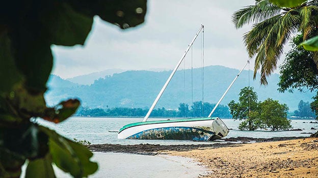
For cruising boaties voyaging north from Moreton Bay and K’gari, coming face-to-face with the southern reaches of the Great Barrier Reef signals a significant and stunningly beautiful shift.
It’s here that low-lying coral cays of the renowned Capricorn Bunker Group, east of Gladstone, are edged by turquoise waters and fringing reefs.

What do the Great Barrier Reef zones mean?
Colour differences for zone markers
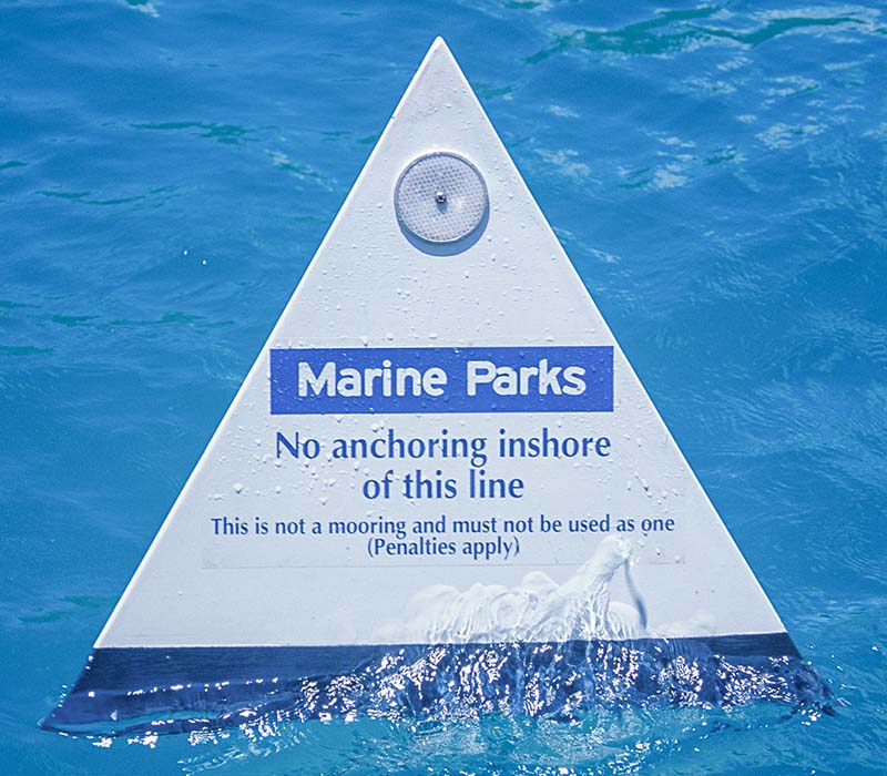
Many skippers will be familiar with Green Zones (Marine National Park) where transit is allowed but all fishing activities are prohibited. Lesser known are Pink Zones (Preservation) and Orange Zones (Scientific) that both signify ‘No Entry’
‘No entry’ means NO transiting, NO trolling, NO anchoring. With no exceptions.
As examples, a Pink Zone surrounding Wreck Island protects the vital nesting grounds of loggerhead turtles.
One Tree Island, being dedicated to scientific research, is strictly off limits to the public. It’s one of only two no-entry Orange Zones in the entire Marine Park.

Plan your Great Barrier Reef trip
The relevant areas are clearly identified in zoning maps and apps. Studying these before departure gives you the confidence to cruise, drift or drop a line within the rules, without second-guessing your position once on the water.
Most importantly, it ensures these sensitive reef systems remain undisturbed, protecting the very experience that draws people here in the first place. Remember, the best trips to the southern Great Barrier Reef are the ones where everything feels effortless. And that starts well before you leave the dock.
Where can you find zoning maps?
You can find zoning maps a number of ways including:
- Download the free Eye on the Reef or QLD Fishing 2.0 apps
- Pick up printed zoning maps from local tackle and boating outlets
- Download digital maps at Reef Authority
Know the reef rules before you go

Brought to you by Great Barrier Reef Marine Park Authority
The Great Barrier Reef Marine Park and its protected islands are managed by the Great Barrier Reef Marine Park Authority with the Queensland Parks and Wildlife Service. Find out more at Great Barrier Reef Marine Park Authority.
RELATED ARTICLES


Any advice here does not take into account your individual objectives, financial situation or needs. Terms, conditions, limits and exclusions apply. Before making a decision about Club Marine boat insurance, consider theProduct Disclosure Statement (PDS)/Policy Document and Supplementary PDS (if applicable). Where applicable, the PDS/Policy Document, Supplementary PDS and Target Market Determination (TMD) for Club Marine boat insurance are available on this website. We do not provide any form of advice if you call us to enquire about or purchase a product.
Club Marine Limited (ABN 12 007 588 347), AFSL 236916 issues Club Marine boat insurance and handles and settles claims as agent for the insurer Allianz Australia Insurance Limited (ABN 15 000 122 850) AFSL 234708 (Allianz). Club Marine Limited is a related body corporate of Allianz. Copyright © 2026 Allianz Australia Limited.